
|
Crater Lake National Park - 1947
This photograph was taken by Leland Prater in 1947. I think that it is important to see images of Oregon's geographical landmarks in different time periods. It would be fun to compare this picture to a more recent one. As a future social studies teacher, I want to develop a unit that focuses solely on Oregon's geography. I think that it is important for students to know their own state on a physical level.
|
|
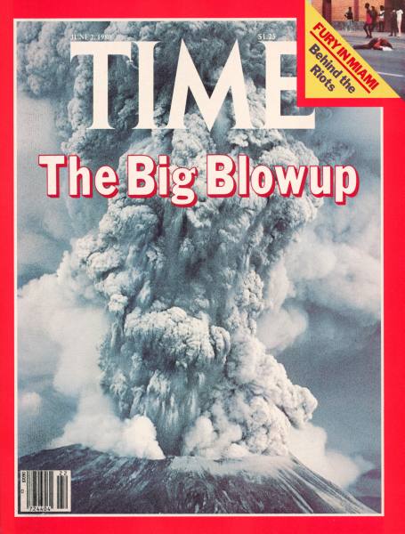
Mount St. Helens Eruption - Time Magazine Cover
This photograph was taken by Roger Werth on June 2, 1980. I believe that this local geographical event is one that is slowly becoming forgotten in time as new generations go through our school systems. The eruption of Mount St. Helens had a dramatic and immediate effect on people throughout Oregon and Washington. I still remember hearing stories from my dad about how the Willamette Valley was covered in ash from the eruption, hundreds of miles away. I think that this topic could be a fun research project for students to explore.
|
|
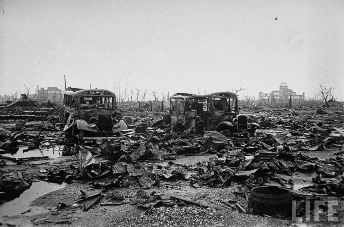
Hiroshima - 1945
This photograph was taken by Bernard Hoffman in October 1945 a few months after the United States dropped a nuclear bomb on the city of Hiroshima. This photograph could be a catalyst for discussions about the environmental effects of nuclear warfare. While this may not be Geography-specific, this photography might also promote discussions about the ethics of dropping the atomic bombs on Japan, was it necessary?
|
|
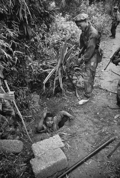
French Indochina War - 1953
This photograph was taken by Howard Sochurek in December 1953 during the French Indochina War. It depicts the ways in which the terrain was utilized by soldiers as a way to hide from their enemies and take shelter from the elements. These strategies were used during the Vietnam War a few years later. I think that studying this war as a precursor to a unit on the Vietnam War would be very beneficial for students to grasp a greater perspective of the global political climate and understand how events link together in a cause-effect relationship.
|
|
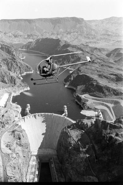
Hoover Dam - Aerial Photograph
This photograph was taken by Grey Villet. It shows the Hoover Dam from an aerial perspective. I think that students would benefit from seeing this as it is a great example of how humans have changed the geography of the earth for their benefit. In an era where the health of the environment is an important issue, I think that this photo could promote discussions pertaining to the ethics of various human activities and their effects on the environment, including hydro-electric dams.
|
